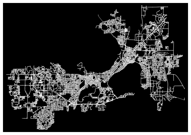
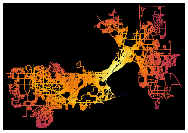
Network Analysis (OSMNx)
For my Network Analysis project, I utilized two Python libraries, OSMnx and NetworkX, to analyze complex road networks. OSMnx enables users to access and analyze OpenStreetMap (OSM) data, and visualize street networks on interactive maps. NetworkX is a comprehensive Python package that provides tools for creating, manipulating, and studying intricate networks. By combining the capabilities of these two packages, users can conduct various network analysis tasks on street networks, such as identifying the shortest paths between nodes, detecting the centrality of nodes, and recognizing communities within the network.
** Visit my GitHub to view the code for analysis steps and visualization.